
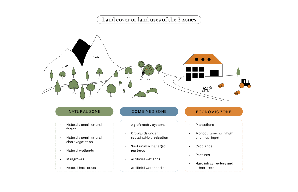
Description
Guidance on defining the 3 Zones
This guide builds on the introduction to the 3 Zones in the 4 Returns Framework chapter. It aims to enhance the shared understanding of your landscape by providing a clear definition of each zone – natural, combined and economic, and the criteria for each land cover/ land use type. It also provides examples of how these definitions can support the development of maps that distinguish each zone within a landscape. This can contribute to the co-creation of a shared 4 Returns vision for the landscape.
Exploring two approaches for defining the 3 Zones
The attached guide explores two approaches to conduct a 3 Zone exercise: (1) using participatory methods with stakeholders, (2) using GIS spatial mapping. The approaches and outlined steps are derived from insights gained through the execution of a 3 zoning and 4R visioning exercise within landscapes. It is important to note that these processes are not strictly linear. Flexibility can be taken to alter the order, incorporate additional steps, or make modifications as needed.
Good luck!
Suggested reference: Wetlands International, Commonland, and Landscape Finance Lab (2024), Guidance on defining the 3 zones.
Illustration: Janina Engel, engel.studio
View tool


